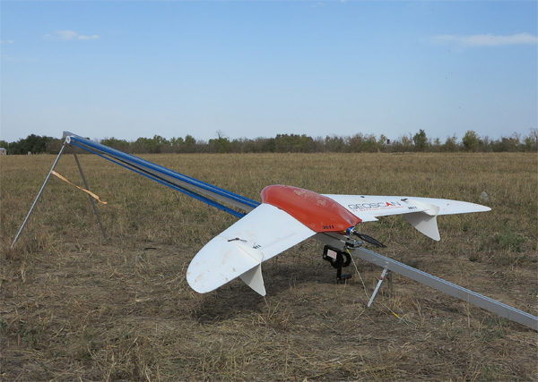
From now on the Center for Remote Sensing and GIS "Terra" offers services for area surveys using an unmanned aerial vehicle (UAV). Surveying is carried out by means of a Geoscan-201 Geodesy UAV. This vehicle is developed by a group of companies "Geoscan" (www.geoscan.aero).
The use of UAVs can significantly increase the economic efficiency of works performed through a considerable cost cutting and reduction of production time.
The vital task of current studies resolved by UAVs use is to acquire spatial data on any object or terrain in an economically and technologically reasonable manner.
Flying along the designated route UAV enables one to acquire accurate and reliable materials on terrain features, monitoring of buildings, structures and linear objects. The acquired data serve as a basis for engineering and geodetic surveys, design and construction, creation of digital and electronic maps, preparation of topographic site plans, development of master plans of settlements, projects for territorial land management etc.
UAV enables one to acquire georeferenced high-quality images allowing for creating and updating digital topographic maps (DTM) of 1:25 000 - 1:10 000 scales, digital topographic plans (DTP) of 1: 5 000-1 : 500 scale.
Aerial photography and in-office studies include:
- obtaining permits for aerial photography;
- aerial photography using Geoscan-201 Geodesy UAV;
- creation of orthophotomaps of required scale;
- creation of digital elevation models.