Geodetic engineering survey is one of the Company's activity areas. Geodetic engineering survey is a complex of works within various projects aimed at acquiring exact and actual data on land topography, existing infrastructure and elements of area planning. These works are used for substantiation of effective operation and elimination of objects, designing new objects, reconstruction and technical upgrading of operating objects, providing area management, surface facilities for sanitary protection zones, land reclamation, construction of protective structures, etc.
 This activity area of CRS & GIS “Terra” develops actively with provision of professional geodetic engineering services. The up-to-date geodetic equipment, advanced technologies, professionalism of employees enables the company to perform to consistently high quality within the shortest possible time.
The company provides a full range of professional geodetic engineering and land survey and management services, including:
- Topographical surveys. Creation of topographical plans to various scales and uses (topographic base), construction of geodetic networks.
- Geodetic surveys at construction. Staking out (setting out works), provision of construction and installation works, preparation of as-built documentation etc.
- Land surveys (geodetic works for land cadaster). Setting coordinates of boundary markers or offsetting known points by coordinates, cadastral survey, preparation of acts on land plot selection, formation of boundary plans, creation of reference boundary networks.
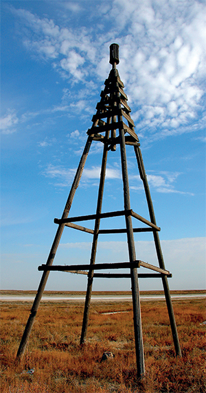
- Tracing of linear structures.
- Geodetic connection of geological openings, hydrologic sections, points of geophysical exploration.
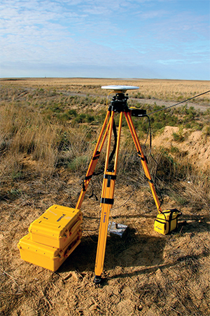
Topographic and geodetic works are carried out to create topographic maps and plans and as a component of geodetic engineering survey process. Topographic maps and plans of large scales are generated based on topographic survey of an operations site (1:500, 1:1000, 1:2000, 1:5000). Surveys are also conducted for smaller scales (1:10 000, 1:25 000 and smaller). Specialized plans based on topographic survey can display all information and objects which directly meet the survey objectives.
Standard topographic survey shows elements of ground situation, points of horizontal and vertical geodetic networks, existing utility lines and site development, and terrain features.
Geodetic engineering survey at construction represents a complex of measurements, calculations, constructions in drawings and at the site providing correct and exact placement of buildings, structures and erection of their constructive and planning elements according to geometrical parameters of the project and requirements of regulatory documents. Geodetic works are a component part of the construction design and operations process, their scope and process flow is defined by phases and main operation technology.
Land survey works - a complex of works to form a new land plot and reorganize the existing land plot, topographic and geodetic works to establish (restore) its boundaries and draw up a cadastral file. Ultimate goal of such works is Land survey (management) project: a complex of technical, economic, legal documents including land plot diagram (plan), data on land plot area, its boundaries and location, information on adjacent owners and users of land plots and any encumbrances and easements on the land plots.
Land survey works are carried out in the following cases:
- when new or existing land survey objects are formed or aligned (establishing design boundaries of land survey object on site);
- when location of boundaries of land survey objects are specified, in case if there is no reliable information on their location, by coordinating boundaries on site (alignment of boundaries of land survey object on site)
- when boundaries of land survey objects are restored, in case information is available in the state land cadaster to define position of boundaries (rerunning boundaries of land survey object).
Land survey works conducted by CRS & GIS “Terra”:
- projects for inter-farm land utilization on forming and alignment of existing land uses, allotment and establishing boundaries of land plots on site;
- development, agreement, approval and delivery of projects of land management of territories, reclamation of disturbed lands and development of new lands and other projects related to land use and protection;
- development of projects for land management, use, improvement and protection of land resources based on landscape and ecological approach;
- topographic and geodetic, mapping, soil-related and other exploration works;
- thematic maps and atlases on land resources condition and use.
 Land management design is the main and integral part of land management process, it is the main way to solve land management tasks; it shows the main context of land management.
The Company specialists provide a full complex of works as a part of the land management project, including graphics and text parts. The graphic part includes project plan (presenting all decisions related to organization of boundaries of the territory), detailed drawings of staking out, maps (geobotanical, land and assessment, agroecological, etc.), charts, graphs and diagrams. The text part includes design assignment, explanatory and calculation report, feasibility study materials, area record, approximate estimates, expert review materials, project review and approval documents and also application software packages, data carriers. Both parts make up the design and estimate documentation.
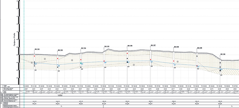
Construction of Vertical and Horizontal Profiles