SRTM (Shuttle radar topography mission) is the international mission to acquire data of the Digital Elevation Model (DEM) of the Earth's territory.
The survey took place in February 2000 onboard the space Shuttle using a radar interferometric camera and two onboard radars SIR-C and X-SAR.
During these works, about 12 terabytes of radar data were shot, which after processing resulted in a matrix of elevations, covering the land area of 60° N to 54° S and some parts of the sea.
SRTM data exist in several versions. SRTM data with a cell size of 1x1 arc seconds (with spatial resolution of 30 m) are more accurate, but unfortunately, only available in the US. Only SRTM data with a 90x90 m cell size and the declared accuracy of not below 16 are available for the rest of the Earth's surface.
In 2014, SRTM digital elevation model was improved to 31 m from 90 m previously available in open access. This latest version represents a significant data improvement compared to previous versions owing to the use of new interpolation algorithms, and local and national DEMs of higher resolution were used as auxiliary sources.
The main purpose of these improvements was to fill the gaps typical for areas with rugged topography, surfaces occupied by water bodies and other terrains difficult for radar surveys (for instance, deserts).
All data is on open access and available for download.
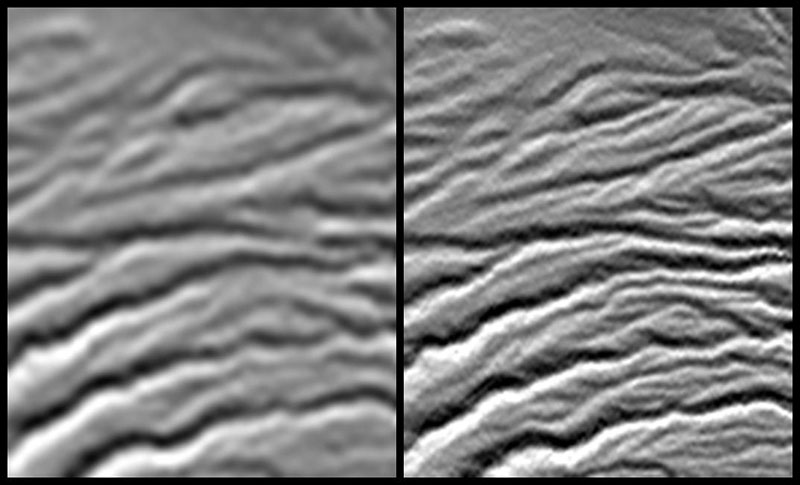
On the left: SRTM with 90 m resolution, On the right: SRTM with 30 m resolution