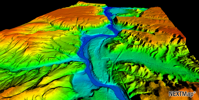
The high-resolution NEXTMap database provides seamless, wide-area digital elevation data and images, collected using a variety of advanced technologies, to enable accurate geospatial analyses across the globe. Developed by Intermap (USA).
NextMap is created by integrating space survey data and DEM (SRTM, ASTER GDEM2, GTOPO30) with improved accuracy through efficient ISE processing.
NextMap database consist of:
- A digital surface model (DSM) containing elevations of natural terrain features, in addition to vegetation and cultural features such as buildings. Cell size: 5 m. Vertical accuracy: 1 m RMSE (1.65 LE90), for open areas with slope of below 10% (accuracy varies subject to data source and territory).
- A digital terrain model (DTM), or bare-Earth model, produced by manually editing the DSM to remove vegetation and cultural features, leaving only elevations of natural terrain features. Cell size: 5 m. Vertical accuracy: 1 m RMSE (1.65 LE90), for open areas with slope of below 10% (accuracy varies subject to data source and territory).
- Orthorectified radar images (ORI) offering a high-resolution, which can be produced regardless of cloud cover (unlike optical satellite imagery). This is effective for detailed feature collection. Resolution: 0.625 m. Horizontal accuracy: 3 m CE90.
The NextMap digital elevation models are available in two versions: NextMap World 10™ and NextMap World 30™.These are commercial products covering the entire Earth surface with an area of 150 million square meters.
Using a proprietary technology, NextMap fills the voids and corrects errors inherent in standard data from available resources, such as ASTER GDEM. This results in the highest quality global elevation models at acceptable pricing levels.
 |
 |