AW3D (ALOS World 3D Topographic data) is a global digital elevation model from NTT DATA and RESTEC (Japan). The product is based on ALOS PRISM data and ALOS archive optical satellite images..
For AW3D, some 3 million image data were used to acquire an elevation model of 5 m resolution for the entire world, provided on a paid basis, and also the elevation model of 30 m resolution based on the same data, but provided free of charge (ASTER GDEM (Global Digital Elevation Model)).
AW3D Product Versions:
Digital Elevation Model (DEM)
- Level 1 DSM (Standard) — digital model of the surface of raw data, defects in the shooting remain uncorrected.
- Level 2 DSM (Standard) —data used to build the model are tested: added uncovered areas, eliminated errors.
- Level 3 DTM — digital terrain model (deducted the buildings and trees).
Orthorectified Images
Panchromatic orthophoto – orthorectified images from PRISM sensor. The area is limited to scene size or area of DSM / DTM construction.
Processed 3D products
Color orthophoto — orthorectified mosaic with 2.5 m resolution for area of DSM or DTM product.
- Resolution: 5 m (DEM); 2.5 m (orthorectified images)
- Accuracy: 5 m horizontal and vertical
- Area: Entire Earth Surface
 |
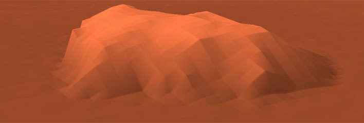 |
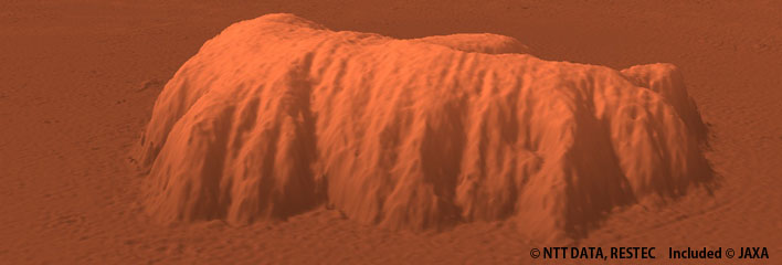
On the left: AW3D with 5 m resolution, On the right: SRTM with 90 m resolution