Продукт ASTER GDEM (Global Digital Elevation Model) разработан совместно Министерством экономики, торговли и промышленности (METI) Япония и Национальным управлением по аэронавтике и исследованию космического пространства США (НАСА).
ASTER GDEM, released in June 2009 (first version), was created on the basis of data from ASTER sensor onboard the Terra satellite. The sensor is capable of producing stereo imagery along the span using two nadir and backward looking telescopes in the near infrared range with a 15 m resolution.
ASTER GDEM coverage spans from 83 degrees north latitude to 83 degrees south encompassing 99 percent of Earth's land mass. Mesh size: 1''x1'' (30x30 m). Absolute vertical accuracy: LE90 - 12-30 m.
To create DEM ASTER GDEM, an automatic processing of the entire ASTER data archive of 1.5 million scenes was used.
In 2011, an improved version of DTM-ASTER GDEM Version 2 was created: new scenes added, errors corrected. Anomalies caused by the lack of data were corrected by adding 350,000 new scenes. To replace incorrect data, other DEMs were used: SRTM, NED (National Elevation Dataset; USGS), CDED (Canada digital elevation data), Alyaska DEM.
As a contribution from METI and NASA to the Global Earth Observation System (GEOSS), ASTER GDEM data is available free of charge to users around the world.
 |
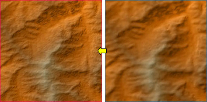 |
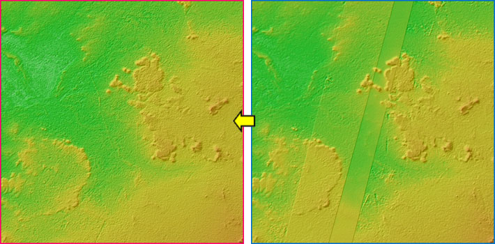
Correction of anomalies.
On the left: Improved product ASTER GDEM Version 2, On the right: ASTER GDEM Version 1.